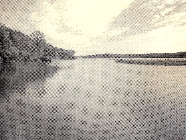
Mattawoman Creek
On Capt. John Smith’s map (circa-1608), the Mattawoman appeared as Mataughquamend, which is a word from the Algonquian language and roughly translates to, “Where one goes pleasantly.
The Mattawoman Creek is a 30 mile long, coastal-plain tributary to the Potomac River with a mouth at Indian Head. It flows through Charles and Prince George’s County. There is a 7-mile tidal-freshwater estuary in Charles County along with about three-fourths of its total watershed also in Charles County.

The Mattawoman is home to a total of 55 fish species. It has twice the population of Largemouth Bass as the Chesapeake Bay, and is a spawning ground for migratory fish such as the River Herring and the American Shad.
It has been said that the Mattawoman represents as near to ideal conditions as can be found in the northern Chesapeake Bay, perhaps unattainable in other systems.
There are two boat launching facilities within the creek; Smallwood State Park, near the mouth and at the end of Mattingly Avenue at Slavin’s Dock, at mid-river.
Potomac River
The Potomac River forms part of the borders between Maryland and Washington, D.C. on the left descending bank and West Virginia and Virginia on the river’s right descending bank. The majority of the lower Potomac River is part of the State of Maryland.
The Potomac River is approximately 405 miles long. It is the fourth largest river along the Atlantic coast and the 21st largest in the United States.
Since the 1800’s the U.S. Navy has been using its 2,000 acres reservation on the Potomac for munitions research and testing.
Despite the Navy’s testing of explosives, the Potomac River and Mattawoman Creek have been untouched at Indian Head. Wooded areas and wetlands along the Potomac and Mattawoman Creek are home to populations of birds, animals, and trees. Several bald eagle nests have been reported near an Indian Head explosion range.
- The Potomac River is situated in an area rich in American history which has led to the River’s nickname, “The Nation’s River”.
- During the Civil War, the Potomac River divided the Union from the Confederacy. It also gave name to the Union’s largest army, the Army of the Potomac.
- In 1864, Washington, D.C. began using the Potomac River as its principal source of drinking water when the Washington Aqueduct was opened.
- The Potomac’s common spelling through the 18th century was “Patowmack.” An earlier spelling was “Patawomeke.” The spelling of the name was simplified over the years to “Potomac”.
- The Potomac River flows into the Chesapeake Bay and affects more than 6 million people who live within the Potomac watershed, the land area where water drains towards the mouth of the river.
Regional Heritage
- In Charles, St. Mary’s and Calvert counties, there are landmarks that help visitors learn about earlier – even prehistoric – times. These three counties are located in the Atlantic Coastal Plain and are easy to reach by water. Many of the people who live in the Southern Region still farm tobacco, corn, wheat and soybeans, and harvest fish and shellfish from the waters of the Chesapeake Bay and the Potomac and Patuxent rivers. There also are many historic sites and environmental treasures such as woods, fields, ponds, swamps and beaches that are preserved for all to enjoy. St. Mary’s City was the state capital until 1695, and was Maryland’s first permanent settlement. To experience what life was like for Maryland’s early citizens, visit Historic St. Mary’s City, an 800-acre living history museum with interpreters in authentic 17th-century dress. There you’ll find replicas of the first statehouse; an “ordinary” or “inn”, a tobacco plantation and the Maryland Dove, a replica of one of the two ships that brought Maryland’s first colonists.


